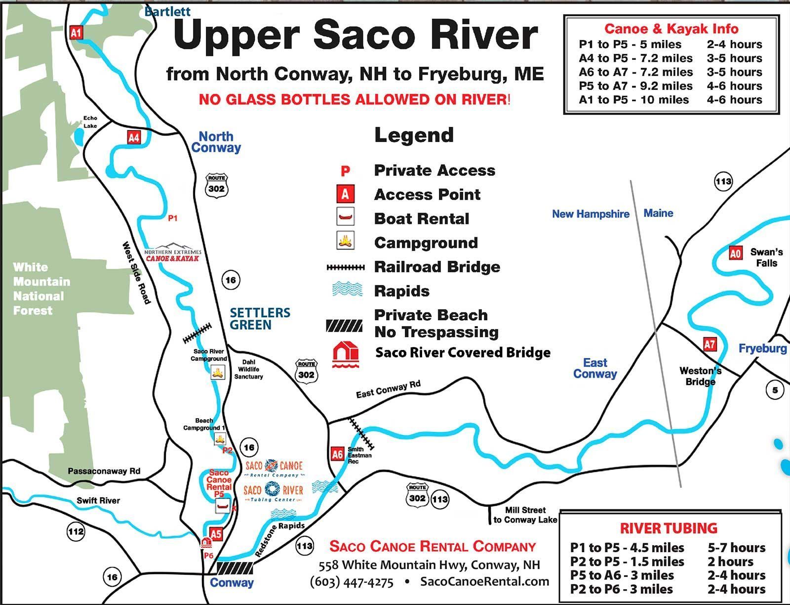
Map of Saco River
Upper Saco River Map
The Upper Saco River, located in the picturesque region of northern New Hampshire and western Maine, offers a stunning natural landscape and exciting recreational opportunities. The map of the Upper Saco River highlights several key features and points of interest:
- River Route: The map outlines the course of the Upper Saco River, including its meandering path through forests, fields, and scenic valleys. It typically indicates the starting and ending points of popular tubing, kayaking, and canoeing routes.
- Access Points: The map identifies designated access points along the river where visitors can enter or exit the water safely. These access points may include public boat ramps, bridges, or designated launch areas.
- Rapids and Obstacles: Certain sections of the Upper Saco River may feature rapids, rocky areas, or other obstacles that require careful navigation. The map may highlight these hazards and provide guidance on how to approach them safely.
- Campsites and Picnic Areas: Many visitors to the Upper Saco River enjoy camping or picnicking along its banks. The map may indicate designated campsites, picnic areas, or other recreational facilities available for public use.
- Natural Attractions: The Upper Saco River flows through a scenic landscape characterized by forests, mountains, and wildlife habitats. The map may highlight points of interest such as waterfalls, scenic overlooks, or wildlife viewing areas.
- Nearby Trails and Points of Interest: In addition to river activities, the map may include information about nearby hiking trails, biking routes, historic sites, and other points of interest that visitors can explore in the surrounding area.
To ensure the best river tubing experience, consider checking the river conditions for current updates and insights before your trip.


